

Preview
Transcription
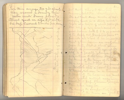
60 Twin Rivers [converge] 200 yds apart flow around a [ ] mtn [mountain] waters unite during floods About equal in size 4 ft wide 6 in deep current 3 miles per hour [sketch: Glacier [womb] Near southern extremity of Toiyabe Range]
61 Hot Creek Mtns [Mountains] 3 species pine Fremont, White Pine, Aristata. The Hot Creek Range reaches its culminating point in a deeply serrate rigde [ridge] at a height of about 10,000 ft. This ridge is very conspicuous at great distances both E & W on account of the deeply cut precipitous towers & pinnacles into which it has been sculpted most of them however are easily climbed from the E. That it should show itself so pronouncedly against the sky is a forcible indication of the [smoothness] of the lines drawn by most of the ranges of the basin. It is rare indeed that any summit in the whole state is found inaccessible to horses not one in a thousand & most of the canons are smooth well graded natural ways however crooked & deep & however precipitous their sides may be. The causes of the comparatively level surface of the canons are first the
Date Original
1878
Source
Original journal dimensions: 9.5 x 16 cm.
Resource Identifier
MuirReel25Journal05P60-61.tif
Publisher
Holt-Atherton Special Collections, University of the Pacific Library
Rights Management
To view additional information on copyright and related rights of this item, such as to purchase copies of images and/or obtain permission to publish them, click here to view the Holt-Atherton Special Collections policies.
Keywords
John Muir, journals, drawings, writings, travel, journaling, naturalist
