

Preview
Transcription
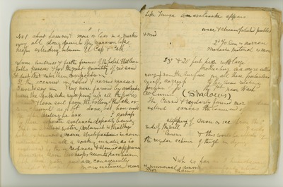
7 the river flows slowly & crookedly its banks protected by ample hedges of dogwood & willow. The N side is also flat but sandy & gravelly, just like Yosem No1 about [Lamour] & more or less in a marked way all along down to the moraine [like] heaps extending between El Cap [El Capitan] & Cath [Cathedral] [Rocks] those gravelly flats are remarkable for their extreme levelness & for the fineness of the polish that [these] pebbles possess & for the great quantity of red sand & dust that [enter] [their] composition If they occurred in ribbed & carved masses I would say [ ] they were formed by avalanches from the south side sweeping up all the pebbles & sand & loose soil from the bottom of the lake or river channel as is oft done, but how would the after leveling be accomplished? perhap by there seperate avalanche deposits being left in shallow water, certain it is that they have experienced a course stratification in some instances & in all a soaking in water as is evidenced by their redness & [ ] appearance moreover some few heaps seem to have been left alone water and are consequently [ ] & [heaplike] in one instance near 8 Lake Tenaya an avalanche appears to have [come] from a smooth S mtnside [mountainside] sweeping a shallow lake bottom bare of all its wave & stream polished pebbles & mud & left it in heaps mounded & [crescents] in form where the 2nd Yo Sem is narrow at up [upper] end, there the moraine material is more heaped against the N wall leaving a steep bank 33° & 20 feet high with large somewhat rounded boulders [producing] in a scare settled way from the surface in all these particulars exactly corresponding to the same relative portion of Yo Semite the 1st near Washington Column (Shadows) the curved & regularly formed moraine dams extending across the lower end of the [lake] as before mentioned are not more affected by the slopping of snow or ice from the S [south] side of the wall than in having [these] S [south] ends [pushed] lower & this would be affected by the regular action of the gl [glacier] in [dying] [because] it would [ ] longer & be [heavier] on the S [south] side giving the form of curve to this moraine wh [which] it possesses & wh [which] as far as I have observed is universal among similarly situated dams as in Bldy [Bloody] [Canyon]: [formed]
Date Original
1873
Source
Original journal dimensions: 15 x 18 cm.
Resource Identifier
MuirReel24Journal02FromBackP07-08.tif
Publisher
Holt-Atherton Special Collections, University of the Pacific Library
Rights Management
To view additional information on copyright and related rights of this item, such as to purchase copies of images and/or obtain permission to publish them, click here to view the Holt-Atherton Special Collections policies.
Keywords
John Muir, journals, drawings, writings, travel, journaling, naturalist
