

Preview
Transcription
The Eastmost branch contains a very [broad] sheet of pine & spruce forest near its source. This forest is planted upon a smoothly spread field of moraine matter mostly terminal from the receding glaciers of the sheltered divide. The other branch is extensively slotted by the erosion of N E [northeast] [seams] Many of the slots are occupied by streams & are hundreds of yds in length. Some places 3[0] or 40 feet deep
Because of the great development of these [seams] many lake[s] [receive] [their] [ ] [ ] [others] [ ] as ridges.
The dividing ridge of the two Forks is precipitous in many places & quite thin owing to the controling & guiding power of these cleavage lines
[sketch: cross section of divide]
Lakes of the two Forks number 12? + 1
[Lakes of] Lyell [forks] 13
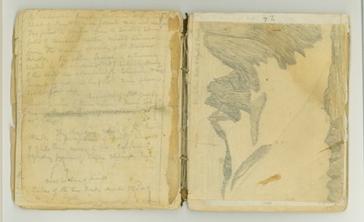
[sketch: gl [glacier] between Ritter & Lyell [E] [east] flank]
Date Original
1873
Source
Original journal dimensions: 15 x 18 cm.
Resource Identifier
MuirReel24Journal02PX63-64.tif
Publisher
Holt-Atherton Special Collections, University of the Pacific Library
Rights Management
To view additional information on copyright and related rights of this item, such as to purchase copies of images and/or obtain permission to publish them, click here to view the Holt-Atherton Special Collections policies.
Keywords
John Muir, journals, drawings, writings, travel, journaling, naturalist
