

Preview
Transcription
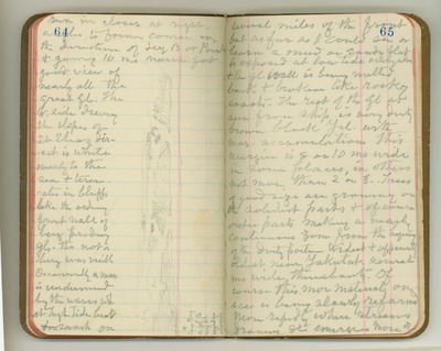
run in closer at right angles to former course in the direction of Icy [Bay] or Point, and going 10 [miles] nearer got good view of nearly all the great [glaciers]. The [West] side draining the slopes of St. Elias direct is white nearly to the sea and terminates in bluffs like the ordinary front wall of berg- producing [glaciers], tho’ not a berg was visible. Occasionally a mass is undermined by the waves [which] at high tide beat awash on several miles of the front, but as far as I could see or learn a mud or sandy flat is exposed at low tide everywhere and the [glacier] wall is being melted back and broken like rocky coasts. The rest of the [glacier] as seen from ship is very dirty brown black [yellow] with moraine accumulations. This margin is 8 or 10 [miles] wide in some places, in others not more than 2 or 3. Trees of good size are growing on the solidest parts and of course outer parts making a nearly continuous zone from the beginning of the dirty of the dirty portion. Widest and apparently oldest near Yakutat, several [miles] wide thereabouts. Of course this moraine material on ice is being slowly reformed more rapidly where streams draining [glacier] emerge. More of [Sketch: Icy Bay and [glacier] to right under clouds]
Date Original
1899
Source
Original journal dimensions: 9 x 15.5 cm.
Resource Identifier
MuirReel29Journal03P64-65.tif
Publisher
Holt-Atherton Special Collections, University of the Pacific Library
Rights Management
To view additional information on copyright and related rights of this item, such as to purchase copies of images and/or obtain permission to publish them, click here to view the Holt-Atherton Special Collections policies.
Keywords
John Muir, journals, drawings, writings, travel, journaling, naturalist
