

Preview
Transcription
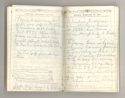
1 mile west from last gap Low gap with string of meadows each side Alt [altitude] 9875 Striae N 40 W Heavy ice flow past here from Black Mtns [Mountains] S [south] side S [South] Fork towards Str [Starr] King In this gap denudation thus [sketch: Slabs 40 ft long 1 to 2 ft thick on clvg [cleavage] lines; 6 ft brod [broad]]
To point on Il [Illilouette] divide whre [where] Str [Starr] King bears N 38 W has been over swept by S [South] Fork ice W [west] from here is broad round basin pointing to Str [Starr] King has fine forests & [meadows] & 2 lakes or more Largest [mor] [moraine] runs a bit to S [south] of St [Starr] King commencing on should [shoulder] of R Mtn [Red Mountain] Whole basin covered with mor [moraine]
Date Original
1872
Source
Original journal dimensions: 7 x 11 cm.
Resource Identifier
MuirReel23Journal07P38-39.tif
Publisher
Holt-Atherton Special Collections, University of the Pacific Library
Rights Management
To view additional information on copyright and related rights of this item, such as to purchase copies of images and/or obtain permission to publish them, click here to view the Holt-Atherton Special Collections policies.
Keywords
John Muir, journals, drawings, writings, travel, journaling, naturalist
